
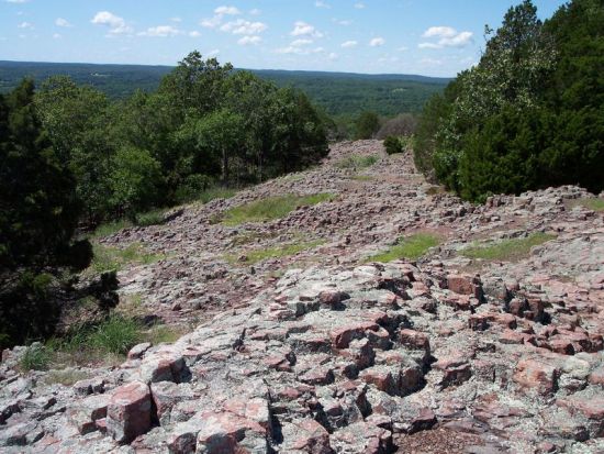
Within the Hughes Mountain Natural Area is a glade with an outcrop of columnar jointed rhyolite designated the Devil’s Honeycomb. Devil’s Honeycomb is listed in the book, Geographic Wonders and Curiosities of Missouri. Two-thirds of the area is wooded. The forest is dominated by post and white oaks with areas of stunted specimens of blackjack oak and black hickory.
The area’s glades are natural openings on western or southern slopes and are dominated by native grasses and a variety of wildflowers. Glades occur where the soils are extremely thin and usually include areas of exposed bedrock.
The area around Hughes Mountain was first settled ca 1810 by John Hughes, his wife (Susannah) and their children, resulting in the mountain being named Hughes Mountain. The mountain itself remained public land until 1861 when purchased by John Hughes’s son, Mahlon Hughes and afterwards remained in the Hughes family until it was purchased by the Missouri Conservation Commission in 1982. At that time it was designated a State Natural Area.
The Hughes Mountain State Natural Area can be accessed by the public via a 1.4 mile (2.253 kilometers) linear/loop trail with the trail head in a small parking area on Highway M 3 miles (4.8 km) southeast of Irondale. Within the Hughes Mountain Natural Area is a glade with an outcrop of columnar jointed rhyolite designated the Devil’s Honeycomb. Devil’s Honeycomb is listed in the book, Geographic Wonders and Curiosities of Missouri. The natural area is divided between forest land (about 2/3 the total area) containing three types of forests, and glades(about 1/3 the total area).
(5 mi. east on Hwy M from Hwy 21)


Trackbacks/Pingbacks